Preliminary Early Report on the 46km W of Illapel, Chile tsunami
Laboratory of Remote Sensing and Geoinformatics for Disaster Management,
International Research Institute of Disaster Science, Tohoku University

Introduction

On 09/16/2015 22:54:33 (UTC) a Mw 8.3 magnitude earthquake occurred.

Preliminary Tsunami simulation results

Updated at Thu Sep 17 18:03:48 2015 (JST)

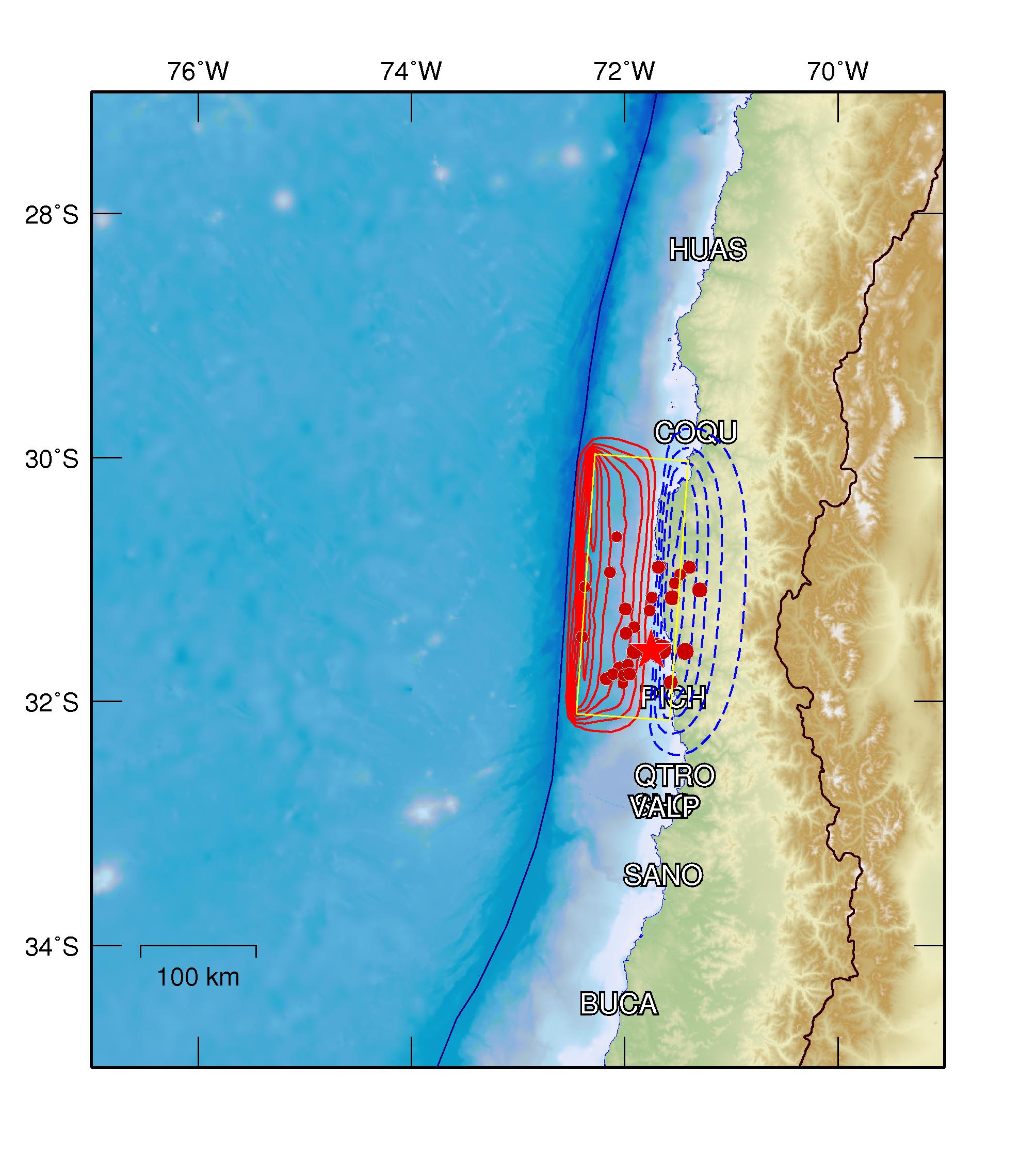
  • Initial conditions
  • Latitude: -31.58 deg
    Longitude: -71.75 deg
    Focal Depth: 12.00 (km)
    Estimated Magnitude: 8.3
    Parameters for simulation. Estimated from Papazachos(2004)
    Length: 290.32 (km)
    Width: 107.37 (km)
    Slip: 3.40 (m)
    The star shows the location of the epicenter. Click on the image to enlarge.
  • Propagation simulation
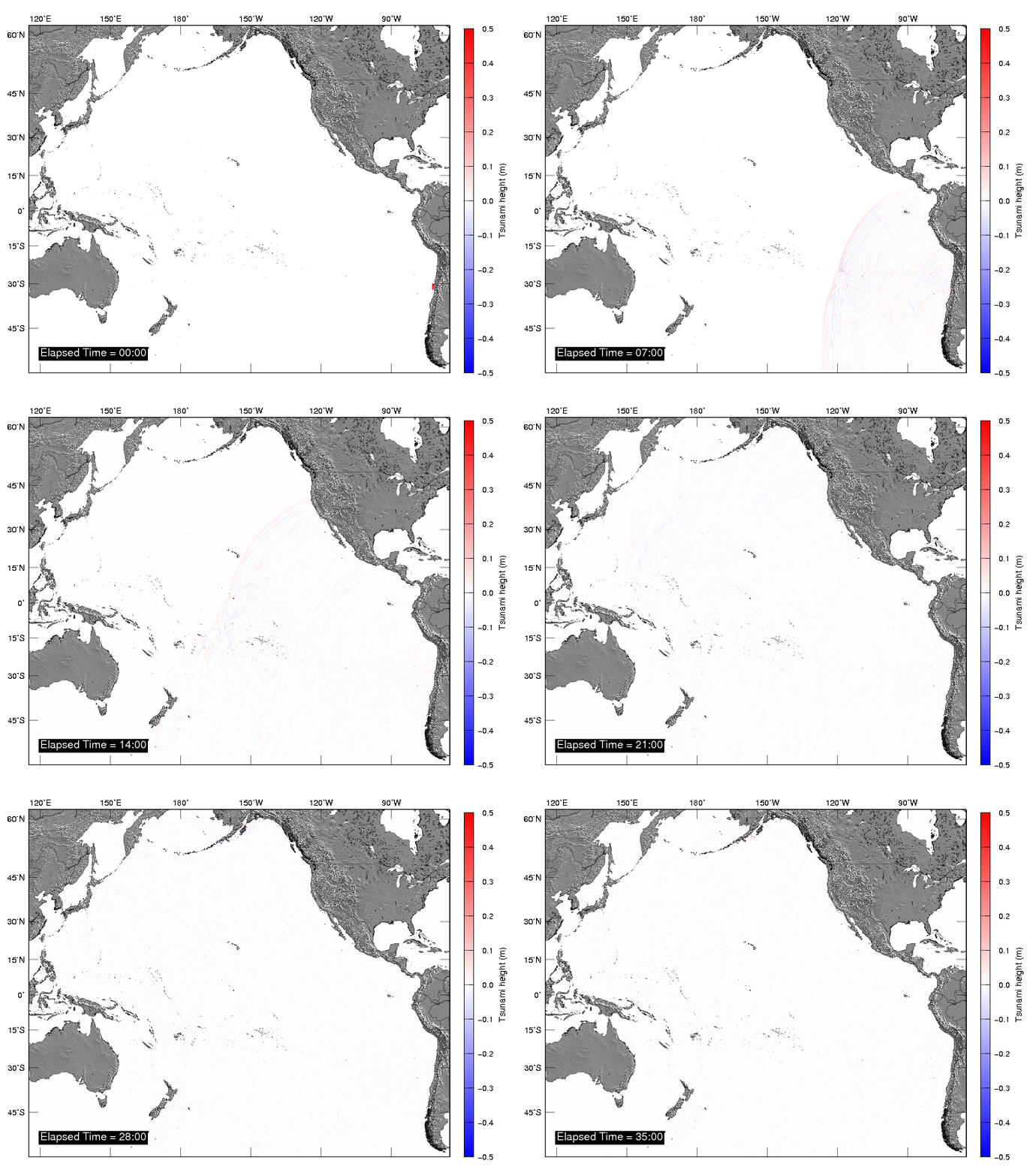
  • Tsunami numerical modeling is performed by using linear shalllow water theory on spherical coordinates with bathymetry/topography grid data of 5 arc-min from GEBCO.

    Governing Equation : Linear Shallow Water Equations
    Numerical Scheme : Leap-frog Finite Difference Method
    Spatial Grid Size : 5 arc-min

    Tsunami propagation

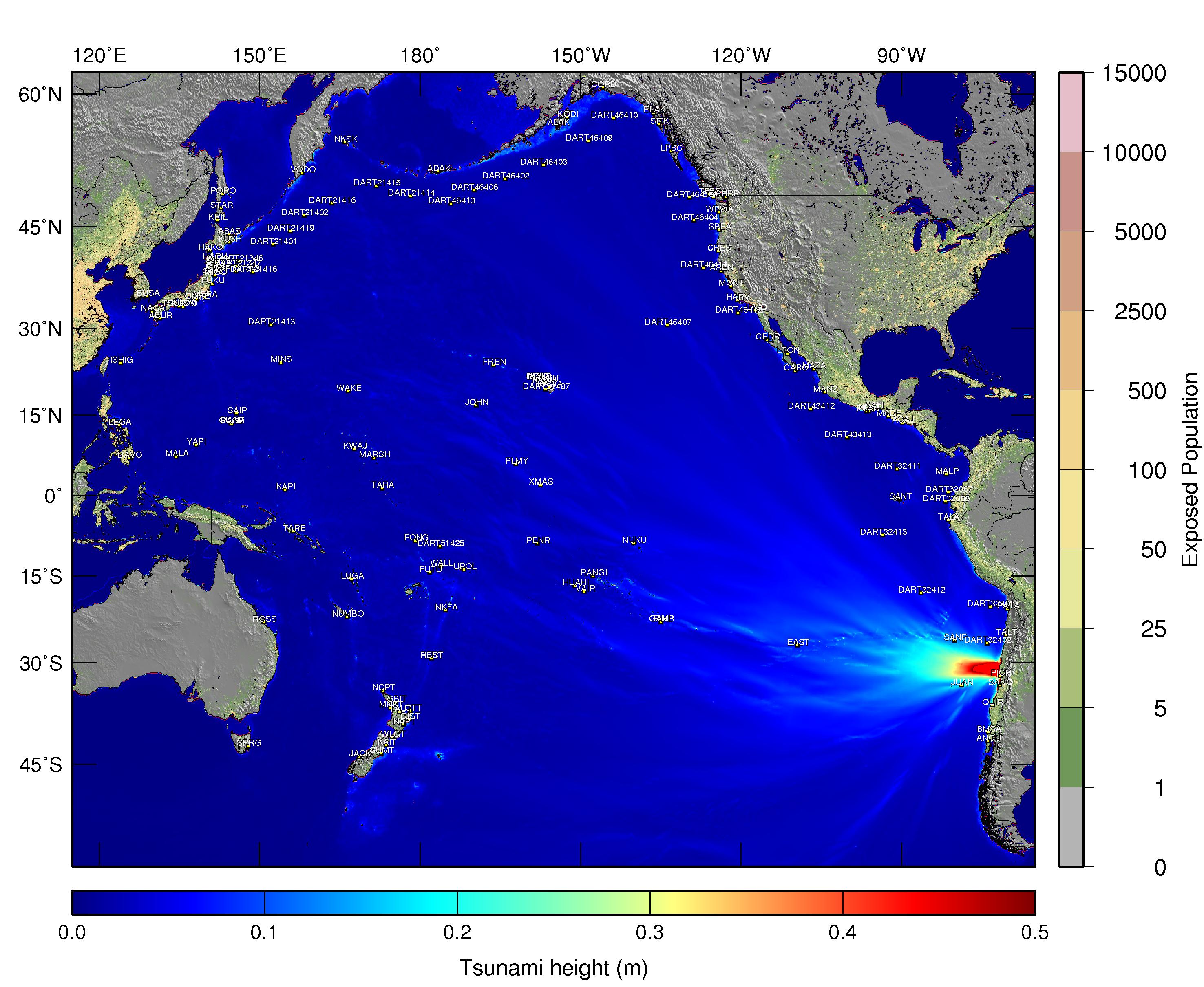
  • Maximum inundation heights
  • Click on the image to enlarge

  • Sea Level Stations:

    Name
    ABAS
    ABUR
    ACAJ
    ADAK
    ALAK
    ANCU
    AREN
    BAMF
    BMSA
    BRPT
    BUSA
    CABO
    CEDR
    CHRP
    CORD
    CRES
    DART21346
    DART21347
    DART21348
    DART21401
    DART21402
    DART21413
    DART21414
    DART21415
    DART21416
    DART21418
    DART21419
    DART32066
    DART32067
    DART32401
    DART32402
    DART32411
    DART32412
    DART32413
    DART43412
    DART43413
    DART46402
    DART46403
    DART46404
    DART46407
    DART46408
    DART46409
    DART46410
    DART46411
    DART46412
    DART46413
    DART46419
    DART51407
    DART51425
    DAVO
    EAST
    ELAK
    FONG
    FREN
    FUKU
    FUTU
    GAMB
    GBIT
    GIST
    GUAM
    HACH
    HAKO
    HARV
    HONO
    HUAHI
    HUAT
    ISHIG
    IWCO
    IWHO
    IWNO
    JACK
    JOHN
    JUAN
    KAHU
    KAIT
    KAPI
    KAUM
    KAWA
    KODI
    KRIL
    KUSH
    KUSM
    KWAJ
    LAJO
    LEGA
    LOTT
    LPBC
    LTON
    LUGA
    MADE
    MAKA
    MALA
    MALP
    MANZ
    MARSH
    MAZA
    MERA
    MICO
    MIHO
    MINS
    MNKT
    MONT
    NAGA
    NAPT
    NCPT
    NKFA
    NKSK
    NUKU
    NUMBO
    OMAE
    ONAG
    PAGB
    PATA
    PENR
    PICH
    PLMY
    PORO
    PTAN
    QUIR
    RANGI
    RBCT
    RFRT
    RIKI
    ROSS
    SAIP
    SALI
    SANF
    SANO
    SANT
    SBEA
    SITK
    SPRG
    STAR
    SUMT
    TALA
    TALT
    TARA
    TARE
    TAUT
    TFBC
    TSURAD
    UPOL
    VAIR
    VODO
    WAKE
    WALL
    WLGT
    WPWA
    XMAS
    YAPI

    News related to the event

    CNN
    BBC

    References

  • Mw 8.3 - 46km W of Illapel, Chile (USGS Earthquake Hazards Program)

  • Contact (Laboratory of Remote Sensing and Geoinformatics for Disaster Management)

  • Erick Mas, Assistant Professor (mas@irides.tohoku.ac.jp)
  • Bruno Adriano, Ph.D. student (adriano@geoinfo.civil.tohoku.ac.jp)
  • Shunichi Koshimura, Professor (koshimura@irides.tohoku.ac.jp)
  • Other useful links

  • International Research Institute of Disaster Science, Tohoku University (IRIDeS)
  • Pacific Tsunami Warning Center (PTWC)