Preliminary Early Report on the
M7.8 - 53km NNE of Amberley, New Zealand of 13/11/2016 11:02:56 (UTC) tsunami (version 0.1)
Laboratory of Remote
Sensing and Geoinformatics for Disaster Management,
International
Research Institute of Disaster Science, Tohoku University
Introduction
A magnitude of 7.8 earthquake occurred in North Canterbury, New Zealand on November 13, 2016 at 11:02:56 UTC. This earthquake occurred as the result of shallow oblique-reverse faulting on or near the boundary between the Pacific and Australia plates in South Island, New Zealand (USGS).
Preliminary Tsunami simulation results
Updated at Mon Apr 14 10:00:00 2016 (JST)
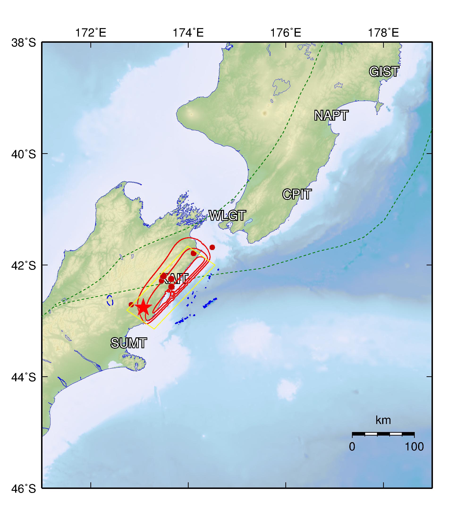
Initial conditions
Latitude: 42.757 deg
Longitude: 173.077 deg
Focal Depth: 15 (km)
Estimated Magnitude: 7.8
Parameters for simulation.
Length: 164.0 (km)
Width: 75.0 (km)
Slip: 1.6 (m)
The star shows the location of the epicenter. Click on the image to enlarge.
Propagation simulation
Tsunami numerical modeling is performed by using linear shalllow water theory on spherical coordinates
with bathymetry/topography grid data of 3 arc-min from GEBCO.
- Governing Equation : Linear Shallow Water Equations
- Numerical Scheme : Leap-frog Finite Difference Method
- Spatial Grid Size : 3 arc-min
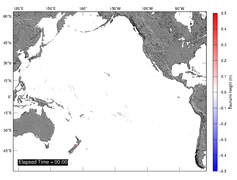
Tsunami propagation
Maximum inundation heights
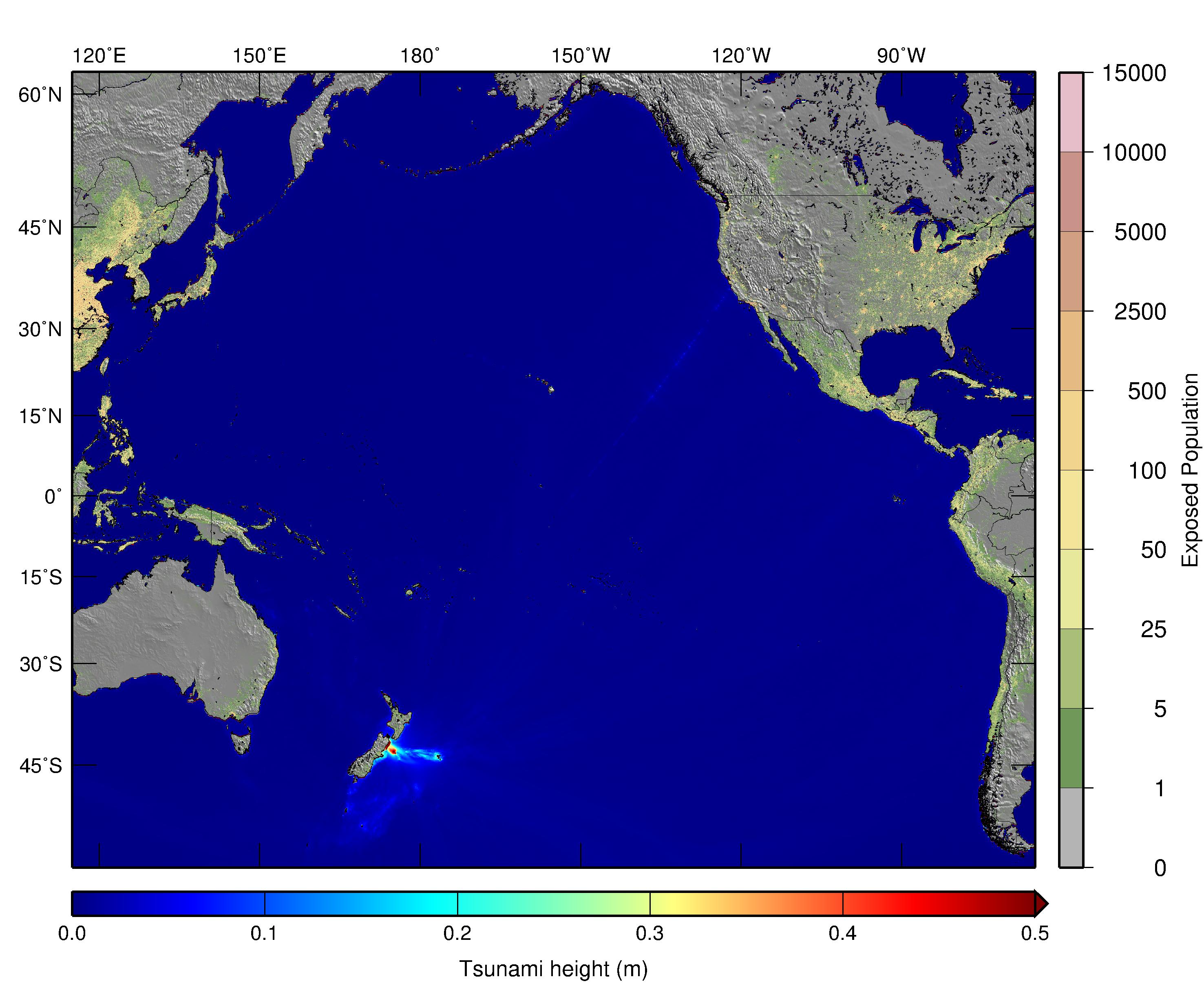
Click on the image to enlarge
Sea Level Stations:
| Name |
| Acajutla, El Salvador |
| Adak, US |
| Ancud, Chile |
| Arena Cove, US |
| Bamfield, Canada |
| Bahia Mansa, Chile |
| BRPT |
| CABO |
| CEDR |
| Cordova, US |
| Crescent City, US |
| Elfin Cove, US |
| Rikitea, Gambier, France |
| Great Barrier, New Zealand |
| Gisborne |
| Hachinohe, Japan |
| Oil Platform Harvest, US |
| Honolulu, US |
| Huatulco, Mexico |
| Jackson Bay, New Zealand |
| Kahulul, Maui, US |
| Kaikoura, New Zealand |
| KAUM |
| Kawaihae, Hawaii, US |
| Kodiak Is, AK, US |
| Kushiro, Japan |
| La Jolla, US |
| East Cape, New Zealand |
| Luganville, Vanuatu |
| Puerto Madero, Mexico |
| MANZ |
| Mazatlan, Mexico |
| Manakau, New Zealand |
| Monterey, US |
| Port Napier, New Zealand |
| North Cape, New Zealand |
| Nukualofa, Tonga |
| Nikolskoe, Russia |
| NUMBO |
| Onagawa, Japan |
| Patache, Chile |
| Pichidangui, Chile |
| Quiriquina, Chile |
| Rangiroa, France |
| Rikitea, France |
| ROSS |
| Salina Cruz, Mexico |
| San Antonio, Chile |
| Santa Cruz, Galapagos, Ecuador |
| South Beach, US |
| Sitka, US |
| SPRG |
| Christchurch, New Zealand |
| Talara, Peru |
| Taital, Chile |
| Port of Tauranga, New Zealand |
| Tofino, Canada |
| Vairao, France |
| Vodopadnaya, Russia |
| Wellington, New Zealand |
| Westport, US |
| Christmas, Kiribati |
News related to the event
CNN
BBC
References
M7.8 - 53km NNE of Amberley, New Zealand (USGS Earthquake Hazards Program)
Contact (Laboratory of Remote Sensing and Geoinformatics for Disaster Management)
Bruno Adriano, JSPS Fellow Researcher (adriano@irides.tohoku.ac.jp)
Erick Mas, Associate Professor (mas@irides.tohoku.ac.jp)
Shunichi Koshimura, Professor (koshimura@irides.tohoku.ac.jp)
Other useful links
International Research Institute of Disaster Science, Tohoku University
(IRIDeS)
Pacific Tsunami Warning Center (PTWC)