Preliminary Early Report on the
71km W of Bengkulu, Indonesia tsunami
Laboratory of Remote
Sensing and Geoinformatics for Disaster Management,
International
Research Institute of Disaster Science, Tohoku University
Introduction
On 08/13/2017 03:08:10 a Mw 6.4 magnitude earthquake occurred.
Preliminary Tsunami simulation results
Updated at Fri Sep 8 17:31:29 2017
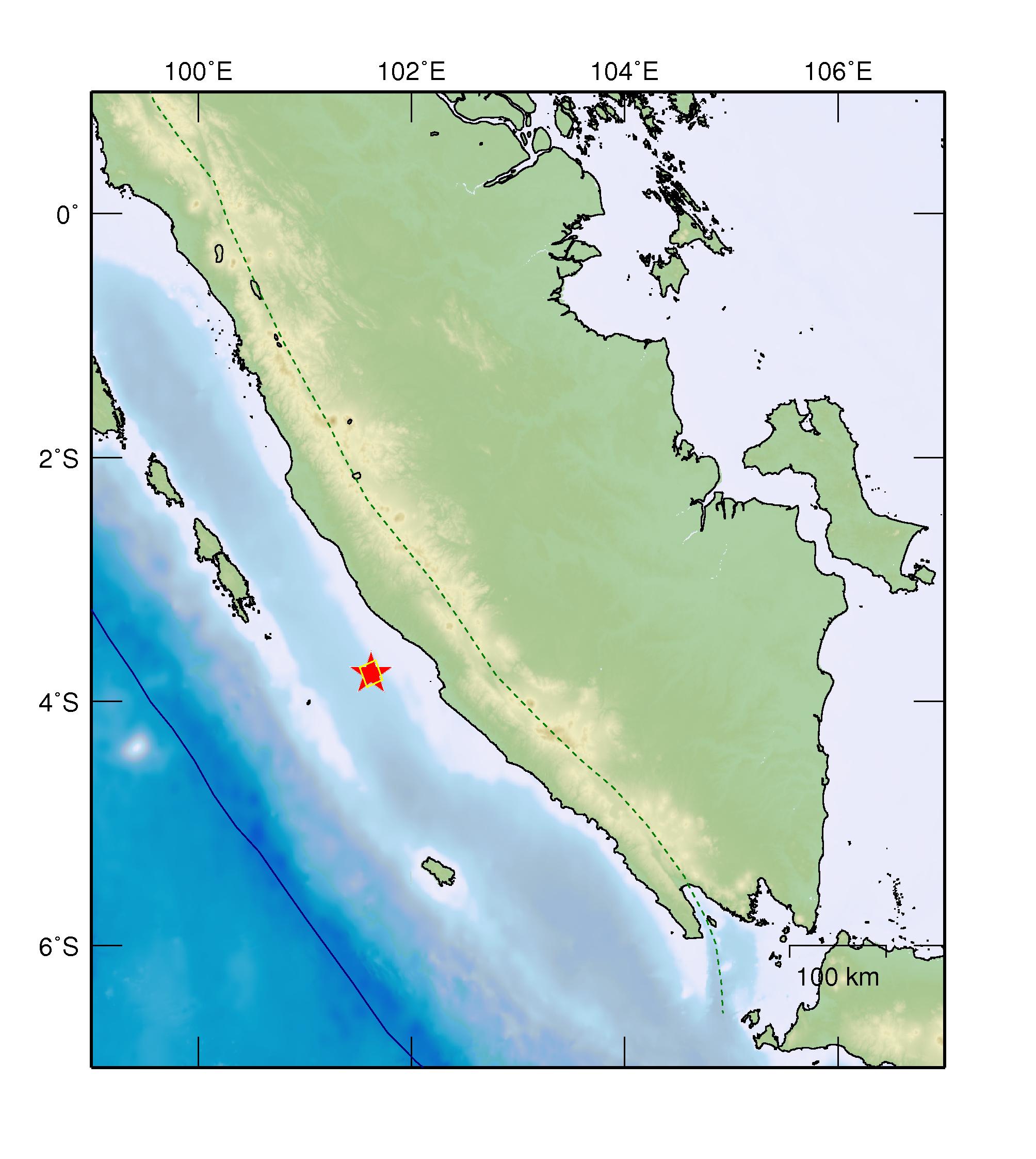
Initial conditions
Latitude: -3.77 deg
Longitude: 101.62 deg
Focal Depth: 31.00 (km)
Estimated Magnitude: 6.4
Parameters for simulation. Estimated from Papazachos(2004)
Length: 21.38 (km)
Width: 22.59 (km)
Slip: 0.21 (m)
The star shows the location of the epicenter. Click on the image to enlarge.
Propagation simulation
Tsunami numerical modeling is performed by using linear shalllow water theory on cartesian coordinates
with bathymetry/topography grid data of 30 arc-sec from GEBCO.
- Governing Equation : Linear Shallow Water Equations
- Numerical Scheme : Leap-frog Finite Difference Method
- Spatial Grid Size : 30 arc-sec
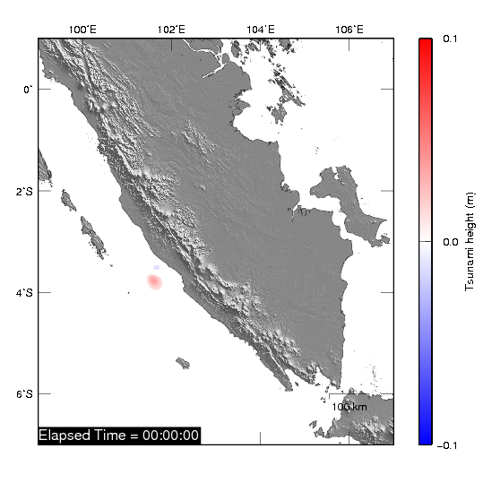
Tsunami propagation
Maximum inundation heights
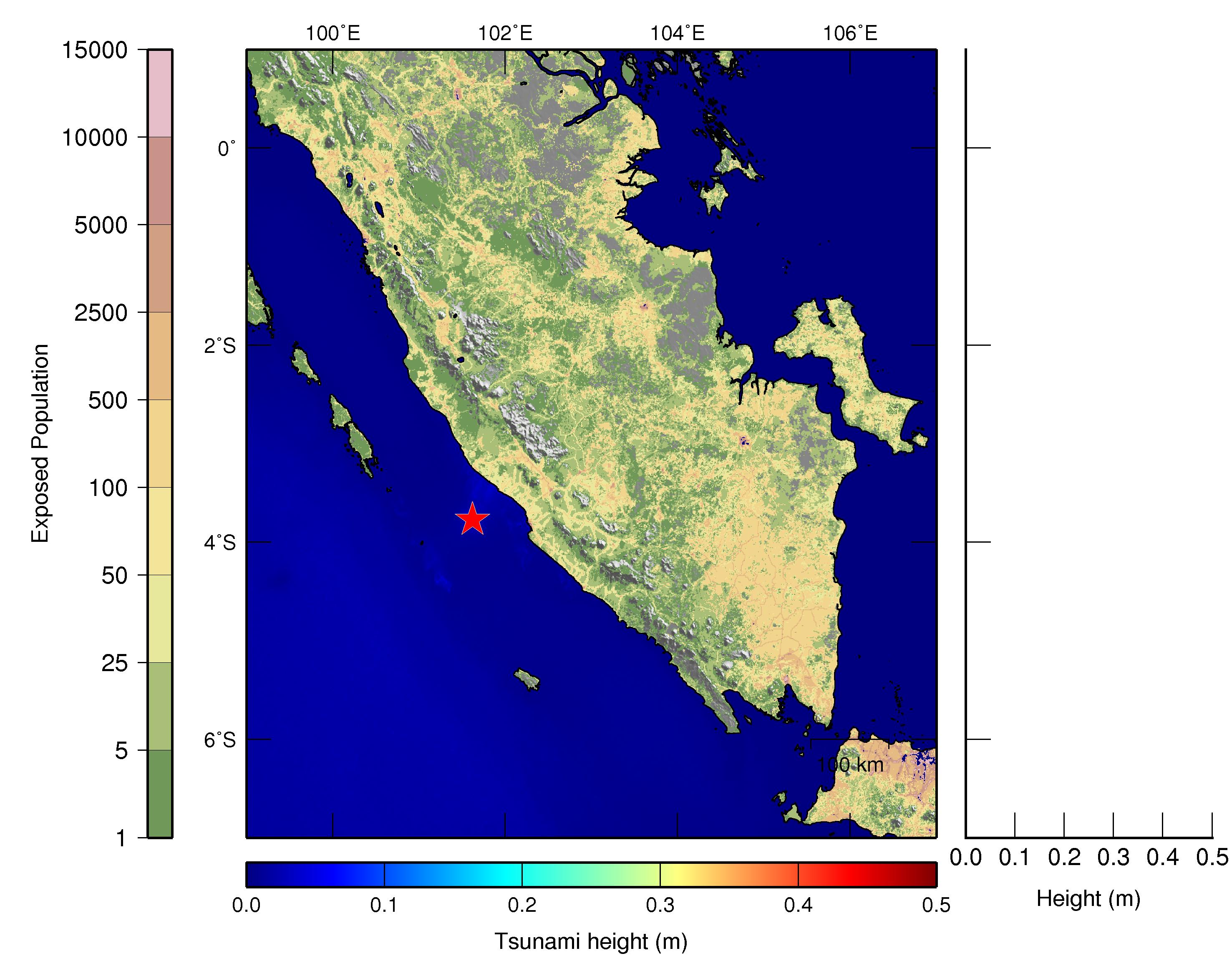
Click on the image to enlarge
Near Sea Level Stations:
News related to the event
CNN
BBC
References
Mw 6.4 - 71km W of Bengkulu, Indonesia (USGS Earthquake Hazards Program)
Contact (Laboratory of Remote Sensing and Geoinformatics for Disaster Management)
Erick Mas, Associate Professor (mas@irides.tohoku.ac.jp)
Bruno Adriano, JSPS Fellow (adriano@irides.tohoku.ac.jp)
Shunichi Koshimura, Professor (koshimura@irides.tohoku.ac.jp)
Other useful links
International Research Institute of Disaster Science, Tohoku University
(IRIDeS)
Pacific Tsunami Warning Center (PTWC)