Inundation Area Extraction of the 2016 Typhoon No.10
Inundation area extraction by SAR Remote Sensing
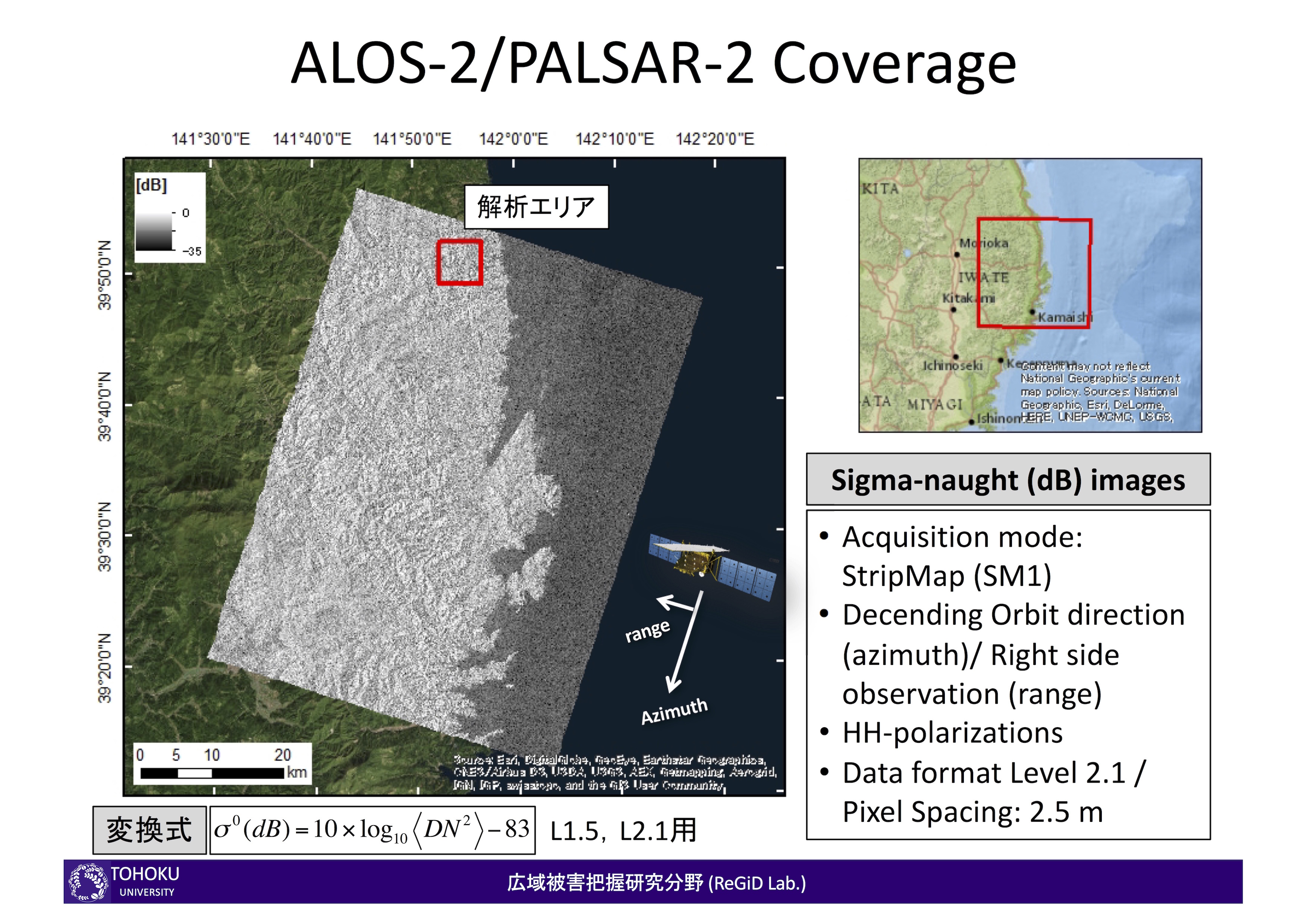
JAXA ALOS-2 data
The analysis was performed for inundation area extraction in the affected area of the 2016 Typhoon No. 10 (Lionrock) in Iwate using the JAXA ALOS-2 PALSAR-2 data.
Results
Note that the results are preliminary and will be updated shortly.
| Acquisition date | Beam Mode | Orbit | |
|---|---|---|---|
| Post-event | 01 September 2016 | Strip Map (SM1) , HH-polarization | Descending |
Post disaster SAR image was used for the analysis. In addition, training data from Google Earth was selected to classify land and water bodies. Moreover, the 5m resolution DEM was used to constraint the areas of extraction near the 20m height. The result is compared to the map of estimated inundation provided by GSI.
- Latest results (2016.09.19) (PDF) LINK
Other Links
- International Research Institute of Disaster Science (Japanese) LINK